Tuesday, February 26, 2019

Thoughts on naming conventions and lock numbering…

I went for a stroll around the junction of the three canals here at the head of the Erewash Canal this morning.
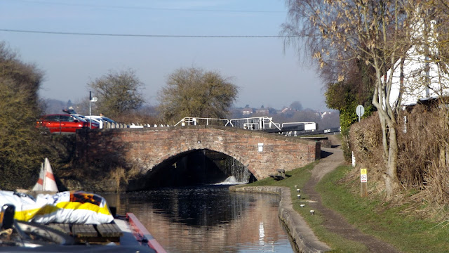
It struck me that the lock numbering was a bit odd; this final lock, Langley Mill Lock, is Lock 14. However there are 14 others coming up from Trent Lock… Then it occurred to me that the penultimate lock we came up yesterday was Lock 73. Eastwood Lock.
Hmm… further investigation required.

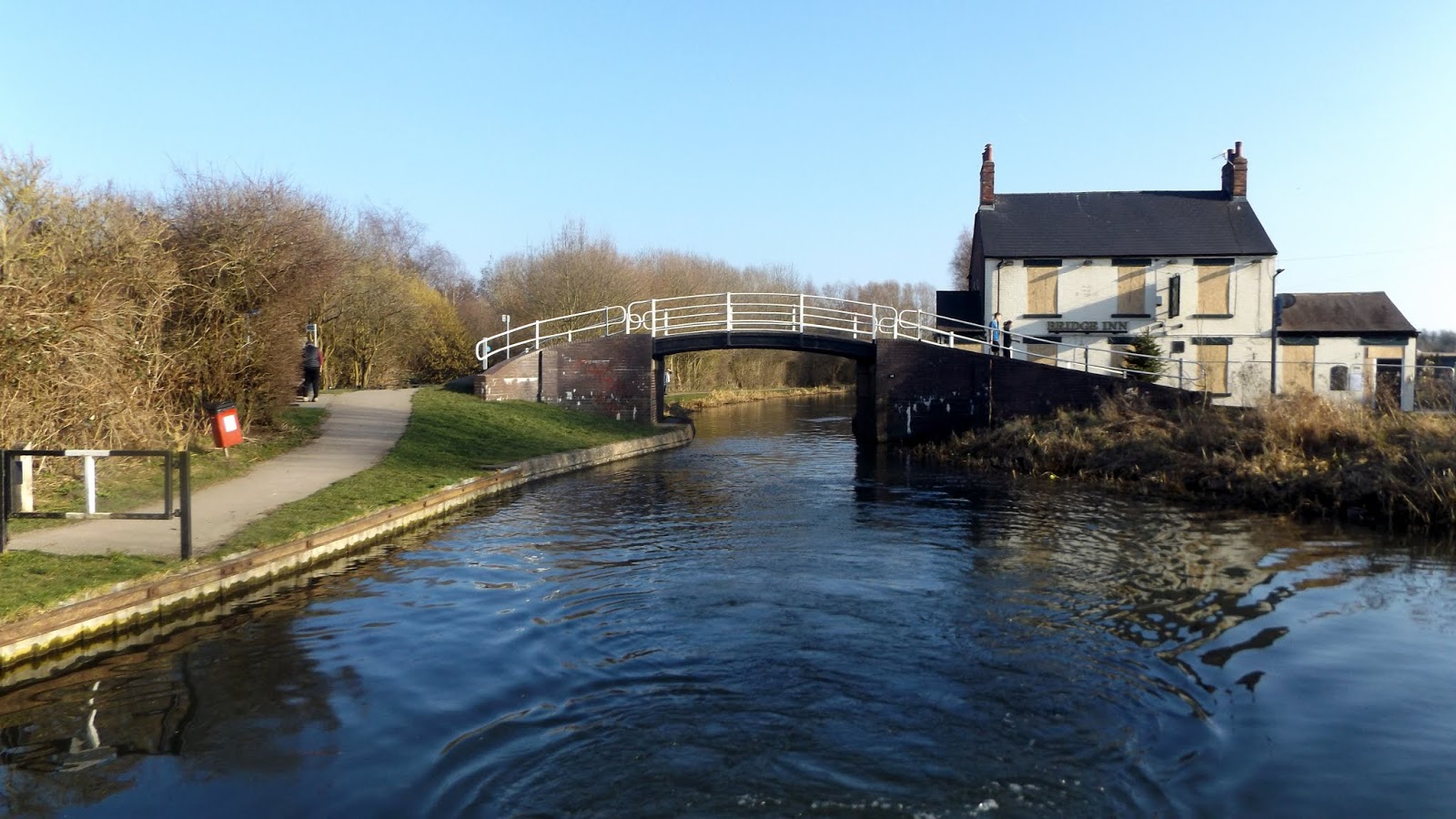
Looking at the junction from the road bridge crossing.
Langley Mill Lock is in the foreground, straight ahead runs the Cromford Canal and to the right, passing under a swing bridge, is the Nottingham Canal.

A little bit of mooching through maps shows that the Erewash Canal lock numbering is a continuation of that of the Leicester Line. Watford Bottom Lock is Lock 1. So I guess these locks must have been renumbered following the absorption into the Grand Union Canal network in the 1930s. That sorts that out.
And the reason that Langley Mill Lock is number 14 is that it’s not actually on the Erewash, it’s the bottom lock of the 14 fetching the Cromford Canal down from Cromford near Matlock.

Up until the construction of the Cromford, the Erewash finished below the road bridge, in a complex of wharfs off to the left of the existing line. These are now filled in and lost beneath a road junction and Lidl’s carpark.


The Nottingham Canal was opened in 1796, joining the Cromford which opened two years earlier. A stop lock was constructed, with a toll house alongside to control traffic to and from the new navigation. It ran from here to the Trent at Meadow Lane Lock. The company intended to construct a branch to the river above Trent Bridge at Beeston, but this was later built by the Trent Navigation Company. The navigation made money, not spectacularly but steadily until the middle of the 19th century when railway competition forced the canal company to cut their losses, selling to the Amber, Nottingham, Boston and Eastern Junction Railway Company. This later became part of the Great Northern Railway, hence the name of the basin and the pub at the north end of the canal.

Looking down on the Great Northern Basin from the road bridge.
The canal has been filled on the other side of the road, the route now forming a footpath.

Walking back “uphill” past the lock, the footpath follows the Cromford for about a quarter mile, before ending abruptly at a dam. This short navigable stub is used for moorings and is the base for Langley Mill Boatyard.

Beyond the dam restoration work is underway, with the ultimate goal of reopening the canal sometime in the future.

There’s a lot more information on the Erewash Canal Preservation and Development Association website here… The Cromford Canal restoration society’s website is here.

We’re going to reverse to the boatyard in the morning for coal and diesel, top up the water tank then set off back down to the Trent. Taking our time as usual.

Locks 0, miles 0   

Monday, February 25, 2019

When you come to the end of the Erewash…

…You have to turn around and head back down again!

We had a long day on Saturday, all the locks were against us, often with top gates open, and there was a lot of folk on the towpath, all seemingly wanting to natter!
We got the life story of one lady who was walking her spaniel Roger, and were nearly sold an early 1960s Bedford Dormobile motor caravan! But all in all a good day.

The impressive Springfield Mill, just up from the Padmore Moorings in Sandiacre.
Built in 1888 as a lace mill, it’s now a Grade II listed building, converted to high-end apartments. A beautiful example of Victorian architecture.

We had eight locks to ascend before our planned stop near Shipley Lock, and were on the move at soon after 10:00. Between Sandiacre and Ilkeston the canal passes through a short section of countryside, but the M1 crossing makes a noisy intrusion. Above Stanton Lock the Nutbrook Canal used to head off to the west, now the only evidence is a stone wall with a pair of pipes sticking through.

Mags in Stanton Lock
The lock is on it’s third name, originally White House Lock it became Junction Lock when the Nutbrook Canal was opened in 1796.
The Nutbrook, named for the Nut Brook which it mainly followed, was built to fetch coal down from collieries at Shipley and West Hallam but was a victim of it’s reason for existence. Plagued by subsidence which required regular repairs, it finally was defeated by railway competition.
The extensive Stanton Ironworks operated from 1787, and the canal was cut through it, presumably to take advantage of a customer on the doorstep. A century later the canal was redundant, replaced by a rail network and all but the first three locks was abandoned. With the closure of the ironworks in 1949 this remaining short section was filled in.

The junction of the Nutbrook Canal with the Erewash is not what it was…

A mile further up the town of Ilkeston starts to appear, mainly on the east side. Gallows Lock sits alongside Gallows Inn next to a main road bridge.
With canalside seating I imagine it would have been busier later in the day.

We had a bit of trouble at Greens Lock. Debris had gathered on the cill below the nearside top gate, stopping it from closing fully. It took 15 minutes of groping about with my long shaft before I could get any sort of seal.

We’d been warned to watch out for low bridges, and the tail bridge at Potters Lock is one such.
After a near miss earlier I’d taken the chimney down.


The Bridge Inn at Bridge 23 is closed. With good moorings nearby I‘m sure it would have been popular with boat crews. But there just aren’t any. Boats or crews. We’ve only seen two moving boats since Trent Lock.


We pulled in below Shipley Lock as planned, although in retrospect we would have been better stopping a little further down before the railway bridge where the bank is better.

With things to do we stayed put yesterday, getting off again this morning. Another beautiful day after a frosty night.

Coming up to Shipley Lock

Another one bites the dust… The Anchor at Bridge 27 is now a private house.

Waiting below Langley Mill Lock, almost at the terminus.

Going up….


We topped up the water tank then turned around, narrowly avoiding a grumpy angler, and moored on the west side of the basin. 

I think we’ll stay here tomorrow. I’ll have a walk around the basin and take some photos. It used to be an important junction, where the Erewash meets the Nottingham and Cromford Canals. Both of the latter are no longer in use here, though, apart from the first short section of each used for moorings.

Locks 11, miles 8 (2 days)

Friday, February 22, 2019

On up the Erewash Canal.

Some people we’ve spoken to, mainly boaters, have called this canal the EARwash for some obscure reason. It never sounded right to me, so I made a point of asking a couple of locals. The conclusion is that the river that runs from near Mansfield, through the valley followed by the canal, and joins the Trent, is pronounced ERRYwash. So we’ll stick to that, then.

The fine weather continues, cool at night but warm and occasionally sunny through the day.

Radcliffe Power Station, on a clear moonlit night.

Yesterday morning we untied from the mooring pontoon and turned around to head for the junction and Trent Lock, Lock 1 of the Erewash Canal.

Below Trent Lock


We rose up the lock, filled our sorely depleted water tank, then tied up a little further along opposite the house-boats.


We stayed the night here, then this morning we set off passing the tediously long length of permanent offside moorings stretching all the way to Bridge 3.

Winding hole on the awkward S bend below Bridge 3.

The only other time we came up this canal we turned around here, I can’t remember why… But from here we’re on unfamiliar waters.

Approaching Long Eaton Lock

When the Erewash Canal opened in 1779 it was mainly rural, carrying coal from the Nottinghamshire Coalfields to consumers in Nottingham, Loughborough and Leicester. But industry grew along the banks to take advantage of water transport, and along with that came housing for the workers. Now the canal is squeezed between the suburbs of Nottingham on one side and Derby on the other. The River Erewash forms part of the boundary between the two counties.

Several lace mills were built along the canal through Long Eaton, now either gone or converted to other uses.


A lone chimney marks the site of one of the factories, now sporting an array of mobile phone aerials.


At Sandiacre there’s a lock house with a stable and toll house alongside the lock.
The lock house was built contemporary with the canal, and the toll house added when the Derby Canal opened in 1796.
The Derby Canal ran from here through the city then on to the Trent and Mersey at Swarkestone, and was relatively successful carrying coal until the railway companies started to compete. By the end of the 19th century the canal was no longer making a profit, and commercial carrying ceased in 1945. Since official closure in 1964 several sections have been filled and built on, the rest falling into dereliction. But there are interesting proposals for restoration…

We pulled in on the offside Padmore Moorings, once a coal wharf and now a handy if a little noisy mooring, away from the cyclists and dog walkers on the towpath.
The Co-op is just across the road, so I was able to get some fresh bread to replace the somewhat unsuccessful loaf I baked yesterday (I blame the age of the yeast) and some fresh veg. We’ll move on tomorrow, not sure how far though.

Locks 4, miles 4 (2 days)

Tuesday, February 19, 2019

Back downriver to The Trent

We left Loughborough on Saturday, another fine, sunny day as we approached Loughborough Town Lock.

We intended to fill with water at Bishops Meadow Lock, but there was a boat already on the water point when we arrived. We pulled over to wait, but he still hadn’t finished after 45 minutes so we decided to head off down the lock anyway. We weren’t desperate, but it would have been nice to top up as things transpired…

Into Bishops Meadow Lock


Below the lock there’s a short cut before the river rejoins the navigation after it’s roundabout trip around the town.


Normanton waterfront.

Above Zouch Lock is one of the radial gates, built to control excess water on this rather flood-prone river.


The fine weather has brought out the anglers on Zouch Cut

We moored for a three nights on the long reach between Zouch and Kegworth, in a sunny spot below Devils Elbow.

Not many boats about at the moment, just a handful each day, including some from the local rowing club and a pair of dragon boats training.


We had a fine sunny start to today, but it had clouded over by the time we got away, and the westerly breeze was cool.
Kegworth Deep Lock was about 20 minutes downstream, past The Hermitage standing on the opposite bank, and then a couple of impressive weirs taking the river around the lock cut.


We struck lucky at the lock, a boat was just about ready to come out so we had the advantage of a full chamber to use.

Dropping down Kegworth Deep Lock, Mags on the tiller, me on the gates, Meg having a roll in the grass…

Kegworth Shallow Lock, used as a flood lock, was open as expected, so we shot straight through, pushed by the increased current as it came through the restriction of bridge and lock.

Ratcliffe Lock was our last on the Soar, then we passed Redhill Marina and came out on the wide waters of the Trent.


The plan was to fill the water tank from the standpipe next to Trent Lock, but, having pulled across the junction, tied up and set up the hose I was disappointed to find that the water had been turned off! Just for the winter I guess, it was working a few weeks ago.

We finished up on the mooring pontoon near the junction, behind a very nice (and very new) Dutch barge. We want to stay here for a couple of days, so I shall have to take the water barrel up to the services above Trent Lock a couple of times to make sure we’ve enough water to last.


Then Friday should see us heading up The Erewash.

Locks 5, miles 9¼ (since leaving Loughborough)

Friday, February 15, 2019

There and back again… and back again!

We moved down to Loughborough again on Wednesday, picking up a locking companion at Barrow Deep Lock.
There was a work crew tidying up around the lock, so the top gates were open, and we were able to leave the bottom open, too.

County Road Bridge below the lock.


Heading towards Pillings Lock.

The plan was to pull in below Pillings Lock at that pile of logs we’d attacked before, and top up the roof again. But we’d been beaten to it…


So we continued on into Loughborough, mooring in our regular spot near Chain Bridge.

After a day off yesterday I’d decided to head back to Pillings Lock and the wood pile today, hoping that the chap and his chainsaw had had his fill and toddled off.

The work on converting the old hosiery mill carries on apace.

Blue skies and silver birches


We were out of luck, there was still the boat moored up taking advantage of all that free fuel. So we winded just before the marina entrance, retraced our steps for a couple of hundred yards and pulled in. I’d actually managed to collect some logs elsewhere on our perambulations, and the towpath along there was wide enough to slice and dice them. Job done and a week’s worth of wood stacked up in the cratch, we had lunch then headed back into town.

The Peter Le Marchant Trust base on the edge of Loughborough.
They run two wide-beam trip boats from here, Symphony and Serenade, taking groups of disabled and seriously ill people of all ages on day or 4-day trips. They also have a specially equipped self-drive 65 foot narrowboat available for weekly hire by a family or group with a disabled member.

Instead of mooring in out usual spot in town we went through Chain Bridge, turned right and moored near The Albion pub.

Chain Bridge

The bridge is at the junction between the original Loughborough and Leicester Navigations, before they were combined into the Leicester Line of the Grand Union network. As such, it’s likely that a barrier would have been in place to prevent unauthorised boats from passing from one to the other without paying an appropriate toll. The barrier, I would guess, would have been a padlocked chain.

After a bit of shopping tomorrow we’ll head off north, looking to moor the other side of Zouch for a day or two.

Locks 2, miles 9½