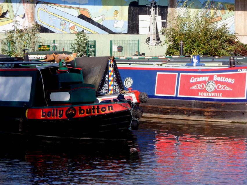
Sunday, October 23, 2011

Downstream and upstream

Down the Trent, then up the Soar, of course.
We had a lazy day yesterday. Well, I say lazy…. after a seven mile run, Meg’s walk, a trip to the shop up in Sawley, then engine checks, battery topping up and emptying the stern tube drip tray I was ready to put my feet up!

NB True heading towards Derwent Mouth yesterday morning
SAM_0012 Trent Morning

Closer shot of the new Long Horse Bridge. It’s certainly an elegant span…
SAM_0013 New Long Horse Bridge

Carol left us to it later in the afternoon, cruising down to Redhill for the night. Her space was soon occupied by a returning Canaltime boat. There’s a continuous stream of these hire boats arriving at or leaving from Sawley Marina.
After a mild night I was up for my long run, a planned ten miler turning into eleven as the access to Attenborough Nature Reserve I’d intended to take was closed off, necessitating a diversion further north. Then a quick walk for Meg, another trip up to the Co-op and we were ready for the off.

Stranded trees on Sawley Weir.
SAM_0033 Sawley Weir (1) 
On Sawley Cut heading for the locks, Ratcliffe Power Station dominating the horizon.
SAM_0034 Sawley Cut

Sawley Locks
SAM_0035 Sawley Locks

There are two lock chambers here, side by side and power operated. No heaving on balance beams or winding paddles on these! In fact it was even better than that. We had a BW lock keeper looking after them today, so I didn’t even have to push a button.
Below the locks we turned sharp left back under the railway bridge to visit the service wharf, then turned around again and headed down to the junction with the River Soar.

Leaving Sawley. The service wharf is under the bridge to the right, the locks to the left.
SAM_0037 Railway Br at Sawley

It’s less than a mile to the junction, which can be a little daunting if you don’t know where you’re going. Straight on takes you on to Cranfleet Cut and points north via Nottingham, left up Trent Lock is the Erewash Canal, 12 miles and 15 locks up to the terminus at Langley Mill. Our route onto the Soar is to the right, then keeping right to avoid the large Thrumpton Weir.

Approaching Soar Junction
SAM_0038 Trent Lock

The Trent Valley Sailing Club sits on the junction.
SAM_0043 Sailing Club

Now heading against the current coming down the Soar, we passed the fine riverside houses tucked up under the red clay and sandstone hill which gives Redhill it’s name.

I fancy one of these. You can see the “Red Hill” behind the properties.
SAM_0045 Redhill

We passed Carol just the other side of the flood lock, giving a toot and a wave, then chugged slowly  past the long line of moored craft to Ratcliffe Lock. There are some good views of the eight cooling towers at the power station along this stretch.

Ratcliffe Power Station from above Ratcliffe Lock
SAM_0049  Ratcliffe PS

This lock was handily empty for us, and I closed up and started to fill just as another boat came around the corner below. There was only about a foot of water in the lock so I closed the top paddles and emptied it again, inviting them in.

NBs Seyella and Phantom in Ratcliffe Lock
SAM_0050  Ratcliffe Lock
Phantom is a 36 year old Springer. These boats were certainly built to last; there’re a fair few of them still around.

Spying a blown-down tree branch close by, we paused in the lock to retrieve it, Dave off Phantom giving me a hand. All securely on the roof, we set off again, around 2 miles to Kegworth.

Cruising on the Soar near Kegworth.
SAM_0051 Soar Cruising

Kegworth Shallow Lock, now flood control only, so normally open both ends.SAM_0053 Kegworth Narrow Lock

We had to wait for a boat going up and another coming down before our turn in the deep Kegworth Deep Lock.

Coming up Kegworth Deep. You wouldn’t want to open all the paddles with a full length boat in there.
SAM_0054 Kegworth Deep Lock
We pulled in around the corner, just past the large house sitting alongside the weir stream. The water is maybe a couple of inches below what you’d normally expect, we ran onto the bottom as we tried to come in. Shuffling back gave us enough depth to get in, though.

Looking across the roof (and the wood) from our mooring.
SAM_0055 Moored Nr Kegworth

The wind has been annoying today, not particularly difficult to handle, but at least it’s been mild. More of the same tomorrow, apparently.

Locks 3, miles 5

Friday, October 21, 2011

Two Days to Sawley

Sorry, didn’t get to post yesterday, we had a visitor in the evening. But more about that later.
We had a bit of a frost on Wednesday night, but once again it led to a fine, sunny Thursday. We toddled the few hundred yards to Stenson Lock to meet a boat coming up, and were joined by NB Water Spirit to drop down.

Following NB Water Spirit into Stenson Lock
Z..SAM_0001 Water Spirit at Stenson
It’s about 3½ miles to the next lock at Swarkestone, through farmland with very few settlements. The canal runs along the edge of the river flood plain, and the villages stand higher up the valley sides.

Heading to Swarkestone
Z..SAM_0005 Near Swarkestone
At Swarkestone we caught up with a Canaltime boat, and, as we weren’t going further than Weston, we hung back and let NB Water Spirit join them in the lock first.

NBs Water Spirit and Buzz Top in Swarkestone Lock
Z..SAM_0017 Water Spirit and Top Buzz, Swarkestone.
It was a fine day but the wind was cold. Mags’ ears were getting chilled as she waited for the lock.

Cold Lugs
Z..SAM_0019
The Swarkestone Boat Club Moorings are in the short arm that is the remains of the Derby Canal. There’s an active restoration campaign going on for this canal, spearheaded by The Derby and Sandiacre Canal Society and Trust. Their objective is “To restore the canal as near to it’s original line as possible”. A fair bit of the original route is still viable, but some sections of new channel will be needed. When reopened the 12½ mile navigation will connect to the Erewash Canal at Sandiacre, and a branch using the River Derwent will take boats up into Derby. Sounds good to me.

Derby Canal at Swarkestone Junction
Z..SAM_0021 Derby Canal
Another hour of gentle cruising saw us arrive and moor up above Weston Lock.

Dappled sunlight below Cliff Wood
Z..SAM_0027

Clear Skies
Z..SAM_0008

Weston Church stands in isolation above the village
Z..SAM_0038

Moored above Weston Lock
Z..SAM_0039

Our visitor, Carol,  arrived for tea, shepherd’s pie and apple crumble.

Good friend Carol
Z..SAM_0001 (2) Carol And Sealy

We haven’t seen her for quite a few months, so it was good to catch up. Her dog, Sealy, likes to make herself at home….

 Double decker dog sleeping. Sealy on Mag’s knee, Meg under her chair.
Z..SAM_0003 (2) Double Decker Dogs

It was getting on when Carol left for home, too late to write and post.

This morning we had a steady start after a milder night. Overcast skies and a stronger wind indicated a change in the weather.
Meg and I took a walk around to have a closer look at Weston Church before we got away. St. Mary The Virgin is mainly a 13c building, with later additions.

Weston Church, closer viewZ..SAM_0004 Weston Church

Looking over the Trent Valley from the churchyard.
Z..SAM_0007 Weston Church

We dropped back down into the village, which seems to be mainly of modern housing. Maybe we missed the best bits. 
We headed down the short distance to Weston Lock and joined a Shakespeare Line hire boat. We ended up sharing all three locks down to Shardlow, where they pulled over to have a look around the village as we toddled on to Derwent Mouth.

Sharing Aston Lock with NB Portia
Z..SAM_0015 Aston Lock

They were a party of Americans, experienced canal boaters, and a joy to work the locks with.

NB Portia’s crew
Z..SAM_0017 Gene. Jane, Larry and Meg from US
L-R, Gene, Jane, Larry and Meg (I hope I got that right!)

Jane and Gene are thinking about basing a narrowboat in the UK for holidays, rather than hiring. They had a look around Seyella, and we had a good chat about costs and equipment.

Heading through ShardlowZ..SAM_0020

We arrived at Derwent Mouth Lock just as two boats were leaving, so they left the gates open for us. There was another waiting to come up, so I was ordered back on board while they emptied the lock and opened the gates for us. Thanks, chaps.

Upper gates of Derwent Mouth Lock. I don’t often see them from inside the lock….
Z..SAM_0025 Derwent Mouth

Motoring out onto the wide waters of the Trent, the new bridge crossing the river is visible on the right.

New footbridge.
Z..SAM_0028 New Horse Bridge

It’s not open yet, there’s still some work to do either end, but this will remake the link from Nottinghamshire to Leicestershire. The county boundary follows the river here. The old bridge, known as Long Horse Bridge, was demolished in 2003 after being found unsafe.
Through the floodgates on Sawley cut and we were looking for a mooring opposite the marina. There was a gap in front of another boat with someone on the roof cleaning the paintwork. It looked familiar, because it was. It was Carol on NB Corbiere, waiting for us.

Carol Corbiere cabin cleaning.Z..SAM_0034 Corbiere

Corbiere looks smart, with newish paintwork on the cabin sides, and new blacking on the hull.
Z..SAM_0035

She’s not bad looking for a 30+ year old boat. Carol’s been doing some work inside, too. The cabin is now lighter and brighter, with cream walls, new lower panelling and new curtains. Smart.

We’ll maybe stay here tomorrow…. or maybe not. We’ll see.

Locks 4, miles 5

Tuesday, October 18, 2011

Blowy but bright.

That pretty well describes today’s weather. We had another cool night, down to 4°, but with the early sun it was very pleasant…. as long as you were out of the wind.
We were going to move on yesterday, but decided not to bother as it was dull and cool. There was plenty of boat traffic about, though. Instead I went foraging for wood and now we’ve a few more logs on the roof.

With the improvement in the weather we decided to push on today. We’ve also done several loads of washing since the last water tank top-up, so must have been getting low.

It was only 15 minutes into Willington, and I was pleased to see the facilities wharf vacant. There’s only room for one boat on there, and with the village moorings being so popular there’s not much space anywhere else to wait. With the blustery wind coming from astern today was not a day to hang about in the middle of the canal!

A boat was just coming around the corner towards us, angling in towards the wharf. I thought “Oh no, that’s blown it”, but a chap jumped off and dropped a bag of rubbish in the skip before jumping back on again.
It was then that I realised it was James and Doug on NB Chance. I knew from their blog posts they were heading this way but didn’t expect to see them quite so soon. Last I read they were still in Nottingham, but it seems they’ve travelled from there to Willington in a day and a half. Makes our piddling 3 mile days look a bit insignificant…. We will meet up for a chat at some point, I promise.

James and Doug head off into the distance at Willington. The boat looks fine, guys.

Topping up the tanks at Willington

Leaving the services we headed off to Findern where the canal does an almost 90° turn to head SE. It was a relief not to have the cold wind blowing from the stern. I had to put a jacket, woolly hat and gloves on to keep it out. Still in shorts though. I try to stick it out till the clocks go back.
It was only a temporary reprieve, though. The wind started to veer to a north-westerly so it was still blowing down the canal, but it’s dropped a bit now.

Not far around the corner is Stenson Marina, and we moored opposite.

Stenson Marina and our stop for tonight.

Just down from us is the first broad lock heading towards the Trent. It’s also the deepest, at around 12 feet.
The navigation was built to broad (barge) width from Shardlow up to Horninglow in Burton on Trent to compete with the then navigable Trent.
The Burton Boat Company had a vested interest in keeping traffic on the Trent, with wharves and warehouses at Bond End on the riverside. They approached Brindley to convince him to terminate the eastward end of the Trent and Mersey Canal at Burton, onward traffic to Nottingham and points east would then use the river. Brindley’s views on the unreliability of river navigations caused him to refuse the request, so the canal was built parallel to the river.
The Bond End Canal at Shobnall was built in 1770 to link the river and canal, but the canal company refused a connection on the grounds of water loss to the lower level of the river. Cargoes had to be transhipped from boat to boat across “Shobnall Bar”.
It took a further 24 years of discussion and argument before the bar was replaced by a lock, allowing through traffic.  

Not sure what we’re doing tomorrow, we’ll see what the weather gets up to….

Thanks for the comments regarding the formatting problem. I've edited this post in the HTML window to correct the spacing, but it's messy, so it  looks like I'll have to investigate this Windows Live Writer thingy.

Locks 0, miles 3

Monday, October 17, 2011

In search of space(s) 3

Ha! Cracked it! Well at least I know the how, if not the why.
When composing posts in blogger you can use a standard WYIWYG (what you see is what you get) text editor, or, if you know what you're doing, you can use an HTML editor. I, and I suspect most, users use the standard text editor.
Viewing the afflicted posts in the text editor they look fine, but in the HTML editor carriage returns seem to have been inserted. These visible CRs are not part of the formatting code, that would be the "< br / >" instruction. The spaces are chopped out where the inserted CRs appear, eg between "new" and "interface".
So a solution would be to view the post in the HTML editor and remove the CRs prior to publishing. This works but is a bit messy.
Hmmm. Just had a thought. I wonder if it's the SIZE of the window I'm pasting the Word document into.
I tend to have open windows at less than full size sIi can easily access a column of regularly used shortcut icons on the right side of my desktop. If the pane where too small to accomodate a full line of text, might it be forced into inserting those CRs?
I'll try pasting into a full width window tomorrow. At least I now know how to correct to errors if they occur.

In search of space(s) 2

I've written this post directly in the edit window of the new interface. I'd rather not do this, as I save each post before publishing as a Word document, named for the date written. So I can easily recover old posts, or scan them for certain items.
I suppose I could copy and paste from here back into blank .doc, but that seems to me to be putting the cart before the horse....
And of course it means I have to be online while I'm typing.

Let's have a look now.

Interesting, eh. No changes in the formatting doing it this way. Must be some sort of formatting flag in Word that the HTML conversion is picking up. Investigation required, methinks.

Sorry if you don't use Google Reader, you probably haven't a clue what these two posts have been about.
Normal service will be resumed tomorrow....

In search of space(s)


Just a quick text-only post today. I’m trying to work out why blogger pinches odd spaces in the post text using the new interface, but leaves it unchanged in the old. This also only happens when using Google Reader, viewed as a “stand-alone” web page it’s fine.
You could say, well, why not stick with the old. I much prefer the far more sophisticated image manipulation in the new. This post is written in Word, then copied and pasted into the edit window in blogger. Let’s see what happens….


As expected several spaces have disappeared.

Saturday, October 15, 2011

Through Burton.

Wasn’t it cold last night! Our rooftop thermometer recorded a low of 1.8°. Still, it’s a price you willingly pay at this time of year for fine sunny days.

Early morning mist (and geese) on Branston Water Park.

We were a bit later getting off than planned this morning. Got a bit lost on my morning run, finally doing 9½ instead of 6½ miles. Then there was a trip up to the village shop for a paper and essentials. So it was around 11:30 when we said our goodbyes to Bruce and Sheila.

Bruce and Sheila and the fine NB Sanity Again

Bright blue sky as we head away from the water park moorings

Our route today took us through Burton Upon Trent and nearly to Willington. At one time there were 30 or so independent breweries in the town, together supplying 25% of all the beer drunk in England. Now, through closures and mergers, Marston’s and Coors are the only volume producers, but there are two or three micro-breweries in the mix.

Shobnall

At Shobnall the remaining stub of the Bond End Canal is accessed under the bridge on the right. Now the home of Shobnall Boat Services, this canal linked the River Trent to the T&M, a distance of less than a mile and a half and rising through two locks.

Under the bridge for Shobnall Boat Services

The moorings alongside the open area of Shobnall Fields had boats on them, the first time we’ve seen this. This was the site of this year’s IWA National Rally, maybe the presence of so many boats in the summer has changed boater’s perceptions about the advisability of mooring here.

Shobnall Fields

Just along the canal we came up behind a short queue at Dallow Lock. Stuffed under a railway bridge this is the last narrow lock on the canal heading downhill. There’s another six broad locks now to the Trent/Derwent junction at Derwent Mouth.

NB Petrel coming up Dallow Lock.

I always enjoy seeing full length ex-working boats in narrow locks. That’s what they were made for, after all.

While we were waiting for our turn we had a visit from Andrew Denny, of Granny Buttons fame. He spotted us there and stopped for a quick chat. It’s a while since we last saw him, down on the Soar.

After clearing the lock we passed his boat moored in Horninglow Basin.

Several buttons at Horninglow

The A38 makes an appearance again, this time on the north side of the canal, and accompanies the canal till Eggington where it continues NE as the navigation bends slightly more easterly. It’s along here that the canal crosses the River Dove on an aqueduct.

The crossing gives a good view of the old road bridge, now redundant with the widening of the road and construction of a modern replacement.

Old road bridge over the River Dove.

With traffic noise diminishing to a murmur and the railway, steadily moving closer from the south, not yet being intrusive, we pulled in near Bridge 24A.

Moored near Br 24A

While we were tying up Susan, a follower of the blog, arrived, walking her handsome American Bulldog, Lincoln. Sorry Susan, we were so busy talking and fussing the dogs that I didn’t take a picture. Good to see you again.

Locks 2, miles 6

Friday, October 14, 2011

Dawdling along.


After a couple of days at Alrewas it was time to move on. Although we’re in no rush, planning to be at Shardlow by the end of the month, we don’t like to stay in one place too long.

I spent yesterday cutting and fitting acrylic sheets to add secondary glazing to the saloon windows. I’m not sure how effective it’ll be, but if we can avoid last winter’s ice on the inside of the windows in the mornings, it’s got to be a bonus. I've still some work to do, but they'll be ready for the cold weather.
Not that we needed it today. After a cool start it’s been a warm sunny day. Tee shirt and shorts the suitable apparel for the weather.

We were ready to move out soon after 10, but then a boat hove into view, heading past us towards Bagnall Lock. Then another. And another….. It was an hour later when we actually got into the lock. Fradley moorings must have been empty by then!


Finally into Bagnall Lock

Through Alrewas, (giving way to a boat in the opposite direction at every bridge) and we pulled over to fill the water tank above Alrewas Lock.

Waiting for a Shakespeare Line hire boat to come through Bridge 46

NB Polly has a shortened riveted iron hull.  Bet she’s some tales to tell…

By the time our tank was full the queue for Alrewas Lock had cleared, so we were able to drop straight down onto the short section of River Trent.

Out of Alrewas Lock onto the river.

The canal builders generally didn’t like to incorporate lengths of natural watercourse into the navigations. Prone to variable water levels they could (and do!) close the canal during wet weather. The advantage however is a good supply of water to feed the locks without having to build expensive reservoirs. James Brindley, chief engineer of the Trent and Mersey Canal, (although he preferred the title “The Grand Trunk”), likened water in a river flowing downhill to a furious giant running along and overturning everything; whereas (said he) "if you lay the giant flat upon his back, he loses all his force, and becomes completely passive, whatever his size may be."

The river comes into the navigation a little below the lock, and the main volume leaves it again only a couple of hundred yards downstream, over a large weir.

Alrewas Weir.

It’s nearly a mile of delightful river before the artificial cut is regained at Wychnor Lock.

Awkward turn under Cow Bridge on the river section.

St. Leonards, Wychnor

Mags waiting for Wychnor Lock

The water level indicator, alongside the bow, is well into the green (safe) zone.

After this lock there’s a 2 mile almost straight section, with the noisy A38 running alongside.

The extensive Barton Turns Marina is on this straight.

Bridge 36 must be the narrowest on the network….

We caught up with the queue again at Tatenhill Lock. Two boats were waiting to go down in front of us.

Queuing for Tatenhill Lock.
  
Aren’t we there yet, Dad?

We pulled over at Branston Water Park, just in front of NB Sanity Again. Bruce and Sheila joined us for a brew and a chat before we settled for the rest of the afternoon.
I reckon we’ll have a short cruise through Burton tomorrow, tying up somewhere out of the way for Sunday.

The new camera seems to be acquitting itself well, although I’ve not yet come to terms with all it’s features.

The zoom is good, this guy was preening in the shrubbery on the opposite side of the canal.


Locks 5, miles 5¼