Friday, July 16, 2010

A very long day….

Eight hours from Worcester to Gloucester. Mostly into a brisk headwind. Certainly puts colour into your cheeks.

We were moored last night right alongside Worcester Racecourse, so Meg and I had to have a walk around the circuit.

Worcester Racecourse and the Cathedral
It was a very wet windy night, and there was a light shower while I was out with Meg this morning, but the sky was clearing as we set off just before 8 o’clock.

The Cathedral from under Worcester Road Bridge
Just a mile away is Diglis Lock, not far after the connection to the Worcester and Birmingham Canal.

Canal Junction

Diglis Lock
We shared the lock with another narrowboat and a dinghy going to act as Safety Boat for a crew painting a bridge below the lock.

Leaving Diglis Lock
The river is pretty remote, villages on either bank hidden by the woods and high banks. Upton is one of the settlements that was built on the river, and is a popular stopping point.

Upton Upon Severn
This morning the moorings were all full, there’s a Blues Festival on this weekend.

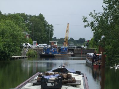
Commercial carrying is all but extinct on the Severn, but there’s still some aggregate moved by barge. It’s only short haul, though.

Loaded near the M50….
And discharged 2½ miles upstream at Ryall Wharf.
There are some exposed reaches where the wind raised some substantial waves to butt through….
The trip had a logical half-way point at Upper Lode Lock. The lock-keeper here gave us advice about the procedure on our arrival Gloucester. He also confirmed that there’s a high spring tide, due to reach it’s height at around 1 o’clock.

Upper Lode Lock
Tides are not normally a problem on the Severn above Gloucester, but high springs back up over the weirs and reverse the flow up to Upper Lode. And that's just what happened today. The lockie at Upper Lode recommended that we pause at the moorings at The Lower Lode Inn till just after 1 o’clock, so we’d arrive at Gloucester to meet the 4 o’clock locking and avoid most of the debris brought up on the flood.

The Lower Lode Inn

The trade here must be very seasonal. Apart from the moorings on the river, there are a couple of caravan sites nearby. Must be quiet in the winter, though.

Avoid the floods. Stick your mobile home on stilts!
We left at 10 past the hour and made good time till Haw Bridge. Over the distance of a mile it felt like we started to slow down, so I checked the GPS and we were down from 5½ mph to just 2½mph as the tide started to flood. I hadn’t expected it to rise so fast. I put on another couple of hundred revs to take her up to 1200 RPM, and managed to get up to 3mph, but wasn't prepared to push it any further.
Pushing against the flow wasn’t the least of it, either. I had to continually slalom around floating debris washing up towards us.

FlotsamThen it was all change as the tide turned at around 3 o’clock, and we gained another 5mph quickly. I dropped the revs and we were still doing 6mph over the ground, dodging logs going in the same direction now.

I gave Gloucester Lock a ring at Upper Parting where the channel splits, the navigable one down to the docks being to the east. The narrower channel speeded up the outgoing flow even more, we were down to just over tickover to maintain steerage as we approached the lock.
The channel veers off to the right at the entrance to the lock and tries to take you with it, so you have to be careful not to get hung up on the bullnose. But a squirt of throttle and a waggle of the tiller took us into the chamber.
After a few weeks of going downhill I’d forgotten that this one is up, and deep with it. Mags had to scramble around to get the longer stern rope out of the locker to tie up.
We were joined by another 4 boats, arriving over the next 10 minutes, and then had a gentle rise up to the level of the docks and the Gloucester and Sharpness Canal.

In Gloucester Lock
Exiting the lock we motored across and moored below the row of converted warehouses on the east side of the dock. There are pontoon moorings here for quite a few boats.

I’ll post some pics of the docks tomorrow. I’ve had enough today.
Although it’s stayed dry, the wind from the southwest has been hard work, and shoving against the current makes a heavy tiller. My shoulders ache tonight.

Locks 3, miles 30.

Thursday, July 15, 2010

On the river.

Yesterday’s forecast was a bit grim, so we decided to stay in Stourport for another day. As it turned out it wasn’t as wet as predicted, but it gave me a chance to have a look around the town and the basins.


View Larger Map

The town has got pretty well everything you need, a couple of small supermarkets, a couple of butchers, hardware store and a chandler. But of course the highlight is the complex of upper and lower basins, the reason the town is here at all. Before Brindley decided to build the link from the Staffs and Worcs Canal to the river here, there was only a hamlet here, called Lower Mitton. Now there’s a small town, with a population in the region of 20,000.

Locking down the lower staircase.
There’re two double staircases of narrow locks connecting the canal to the basins and the river, and a pair of single broad locks.

Looking down from the top of the upper staircase.
We intended getting off early today having seen traffic building at York Street Lock yesterday. But on my morning run back up the canal towards Kidderminster I counted eight hire boats tied up, pointing in our direction. Now I’m not against hire boats at all, after all it was how we started. But not en masse…. So it was a quick shower, a quick “ablution walk” for Meg, and we were off at 07:45. (No, that’s not a typo…).
We still weren’t the first down the lock though, NB Bunbury just beat us to it.

Taking our turn down the deep York Street Lock.
We had to stop for water and the usual tank emptying just below the lock, and were overtaken by the first of the hire boats.

Going down the staircases proved interesting, complicated by a boat coming up from the river. The leading downhill boat had to pass in the awkward small pound between the two pairs.

Fun in the sun
We followed down without incident and were on the river by 09:00.
The windlass was stowed, we’ll not be needing that again for a couple of weeks, and we set off for our first river lock at Lincombe.
These are not huge locks like those up in South Yorkshire, or on the Trent, but you could breast up three full length narrowboats in the chamber.

Leaving Lincombe Lock.
Lots of trees
We had a bit of a delay at Holt Lock. BW were loading a barge with timber from a Jewson truck on the lock side, but it meant we could share the lock.

Holted
Three-quarters of an hour later we arrived at Bevere Lock. We had to wait here, too. Somehow a small cruiser had managed to insert itself between us and the boat in front and there wasn’t room for all of us at once.

Lock Dog unsure whether to bark or not.
Between Holt and Bevere Locks the Droitwich Barge Canal used to head off to….. well, Droitwich! Then continued as the Droitwich Junction Canal to link up with The Worcester and Birmingham at Hanbury Wharf. Both lengths are under restoration, due to reopen later this year.

Hawford Lock, Droitwich Barge Canal. Soon to see boats?
Something you don’t see very often, Mags on the tiller on a river!
We arrived at Worcester at around 13:30, and pulled up on a mooring alongside the racecourse. Had to shuffle around a bit to get a satellite signal, TV from the aerial is non-existent. Internet is cracking though.
We’ve spent the afternoon watching the boats go by.

Pride of the Midlands with a load of schoolkids
Seeing double, a breasted up pair of Black Prince hire boats.
Most of the hire boats today are from Black Prince at Stoke Prior, heading back for hand-over day on Saturday. They’ll turn off the river here and head up the Worcester and Birmingham Canal. Still a bit of work to do, 13 miles and 22 locks.

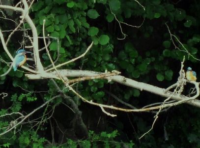
And finally I got a shot of a kingfisher. Then I saw there was not one, but two!
These moorings are run by the council and there’s a £3.50 fee. I was hoping we’d get away with it (tight or what) but a very pleasant young man tapped on the window not long after 4. Still, we got a map of the city off him.

Expensive Map…
Locks 8, miles 12

Tuesday, July 13, 2010

Rainy Stourport

There were some keen boaters around this morning. By the time we moved off at just before 9, no less than 5 boats had already gone by, heading down to Stourport. I think they’d seen the same weather forecast as us, rain moving in in the afternoon. It wasn’t wrong, either!

Shortly after we got off we passed from Staffordshire to Worcestershire, marked by a boundary post erected by the canal society.

Boundary Marker.
That ridge of red sandstone makes it’s presence felt again at Austcliff, ominously overhanging the navigation on a sharp left bend.

Austcliff
.
The first lock encountered was another couple of miles further on, and the convoy of 5 had all gone down bar one, so we only had a short wait. There were three waiting to come up though.The lock cottage has been empty for some time. It’s good to see that it’s finally getting refurbished.

Debdale Lock Cottage.
The canal continues to wind down along the Stour valley, through Cookley Tunnel with the village perched on the top…..

Cookley Tunnel

And on down to Wolverley.

Wolverley Lock
At Wolverley Lock there’s a big pub, The Navigation, and on the opposite side The Old Smithy is a tea rooms, right alongside the lock landing. The smell of bacon butties made my taste buds go into overdrive, but I resisted the temptation.

You can't keep a good tree down....
Another lock and the outskirts of Kidderminster are introduced by a rash of new houses.

New developments flank the canal


We pulled over near Bridge 17 for a quick trip to the handy Sainsburys, then round the corner to Kidderminster Lock, in the shadow of St Mary and All Angels.

Approaching Kidderminster Lock.
Leaving the lock under the main road is not quite so edifying….

The canal leaves the town behind at Caldwall Lock, then reaches Falling Sands Lock ½ a mile later. This lock is named for the loose ridge on the west bank, and used to have a lock house, no trace of which remains. It still has it’s narrow cast iron tail bridge though, with a slot through which the tow rope could pass.

Falling Sands Lock
It was here that the rain came on, and has been pretty well continuous since.
There used to be ironworks along the length of the canal, now remembered only in place names. Greensforge and Wolverley Forge Bridge are examples.
There used to be a large foundry down in the river valley at Wilden. It’s now an industrial estate. It used to be accessed from the canal under this towpath bridge at Pratt’s Wharf, down a now derelict lock.

Pratt’s Wharf.
The rain came on quite heavily as we came into Stourport, so the camera stayed under cover. We moored above the deep York Street Lock at around 14:30, on our own at first, but there’re are several boats here now.
We’ll see what the weather does tomorrow before making a decision about dropping down to the river. After a couple of long days we might just be due a day off….

If you’re up on the Leeds and Liverpool and heading west you’d better get a move on…..

From BW -
Lock 30 Holme Bridge Lock Gargrave to Lock 85 Railway Lock Wigan

Monday 2 August 2010 until further notice

Due to a prolonged period of dry weather, we will no longer be able to sustain the supply of water to the Leeds & Liverpool Canal. As such, the canal will close on 2 August 2010 from Lock 30 (Gargrave) to Lock 85 (Railway Lock) on the Wigan Flight and navigation will not be possible along this stretch of the canal.
This is in order to protect the integrity of the canal and reservoirs and safeguard the aquatic habitat.

All flights will be locked West of Holme Bridge Lock (30) and East of Railway Lock (85) Wigan will be padlocked and stop planks will be installed at the top of each flight from 2 August 2010.

Please be advised that the current restrictions on the Leeds & Liverpool Canal will remain in place for the remainder of the canal.

We will continue to monitor the situation and will keep you updated of any significant changes as and when they occur.
Please be advised that pounds will naturally drain once the feed from the reservoirs is no longer in place.
We advise caution when accessing your boat during periods of low water and that you regularly monitor and adjust your mooring ropes.


Please follow instructions of BW staff at all times.


An update will be issued on Monday 9th August 2010.


British Waterways apologises for any inconvenience this may cause.


Enquiries: 01942 405700


I guess the fishermen will be pleased.....Roll

Oh, and Steve. Just Heaven looked fine.

Locks 7, miles 9¼

Monday, July 12, 2010

Not used to this wet stuff!

Rain! Not had any of that for a while. And yes, I know we need it and all that, but why can’t it come at night when we wouldn’t notice it as much?

We’d intended quite a long day today, and that’s what we got, but progress wasn’t as good as planned.

It was just a light wetting as we left Hinksford Lock, which got heavier and heavier as we headed for Greensforge.

Beautifully decorated boats at Hinksford.
We pulled up at the services at Greensforge in heavy rain, and decided to wait it out, so pulled back onto the moorings. We were tempted to call it quits and stop the night there, but the sky lightened and the rain eased about 11:30. So we decided to get going again. Trouble is, everyone else had got going by that time as well, and we finished up queuing at every lock today apart from the last one.

Queuing at Rocky Lock
Our 8 o’clock start was a complete waste of sack time.
At this lock the red sandstone ridge that runs on the east bank of the canal makes it’s first appearance.
Where the “rock” in Rocky Lock comes from…
The navigation winds back and forth to Kinver, sandwiched between the ridge and the river Stour. At one point it cuts through the sandstone, in the rough-hewn Dursley Tunnel.

Dursley Tunnel, only 25 yards long.
Stourton Junction.


The Stourbridge canal heads off to the left here, climbing steeply up 29 locks to Netherton Tunnel and the Birmingham Canal Navigations Main Line.


Stewponey Lock and wharf are a short distance south of the junction.

Stewponey. The building nearest the lock is the restored toll office.
We were surprised to get an email from Amy on NB Black Briony over the weekend. She’s moored near Hyde Lock. We didn’t know she was down here. So we kept a look out and pulled in for an hour’s catch up chat.

Amy and NB Black Briony.
Hyde Lock
The lock cottage has a beautiful front garden, inspired by it’s location.
It’s a fine spot, but we decided to shove on a bit further, to the other side of Kinver.
We dropped down Kinver Lock with it’s modified balance beams to clear the widened road bridge.
Kinver Lock, bottom gates.
Then down Whittington Lock and stopped just below the lock bridge on a nice quiet mooring. There was only one other boat here when we arrived, but they must have wondered what was happening. Another three followed us down the lock and moored as well. The “nice quiet mooring” suddenly got busy!

Locks 8, miles 7

Saturday, July 10, 2010

Early start, early finish.

We got off early again today, and this time it was – just before 8 o’clock! Two reasons really. There were a couple of potential pinch-points on today’s trip, and we wanted to get moored up before it got too hot this afternoon.

So we were up, Meg walked, and into Dimmingsdale Lock at 8. We just made it before a boat coming down from Compton. I felt a bit guilty, but they weren’t in sight when I filled the lock, only appearing when I pulled over to the top gates.It was fortunate as it happens, being first on the water we had the advantage of catching any locks that were full. The following boat had to refill each as they came to them.
We cleared the first three locks in quick time, arriving at Bratch Locks after only an hour. There was no-one about when we were here last time, but during the summer there’s a lock-keeper on duty.
These three locks are very close together, with only a very short pound in between. The water to fill the chambers is held in side ponds, similar to the staircase at Foxton. They were originally designed as a staircase, but re-engineered as single locks to save water.

Coming down Bratch Locks. The tower structure is the lock-keepers lookout.Operation isn’t rocket science, you just have to make sure that there’s somewhere for the water to go before emptying each lock, but the lockie is on hand just in case. Blue before Red in this case.
The lock keeper explains how they work to a couple of young gongoozlers.As they are so close together, it’s one way traffic at any given time, and we were lucky to arrive just before another two arrived at the bottom.

Two boats waiting to go up.
Shortly after is the delightfully named Bumblehole Lock. With those two recently coming up it was ready for us to go straight in.

Variation on a theme – pear-shaped bywash weir at Bumblehole LockBotterham Staircase Locks were another potential hold-up, but once again we arrived just nicely, and were down the pair in 20 minutes.

Out of Botterham Locks.
Then just two more locks around the village of Swindon, a quick stop for a paper from the handy shop near Swindon Bridge, and we pulled up just above Hinksford Lock.

Moored at Hinksford.
We were here in plenty of time to watch the qualifying rounds for tomorrow’s Silverstone Grand Prix. It looks like the McLaren boys are going to struggle against the dominant Red Bull cars of Vettel and Webber. Hamilton is 4th on the grid, but Button failed to get to Q3 and is slotted in on 14th. Still, it can all change on the day.

Locks 11, miles 5½