Thursday, July 22, 2010

Purton Hulks

Just south of Purton the Gloucester and Sharpness canal runs very close alongside the Severn, forced to do so by a ridge to the south which also pushes the tidal river into a loop.
View Larger Map

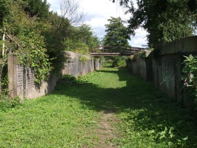
This section was vulnerable to being undercut by the ferocious tides and fast floods on the river. The solution was to build some sort of breakwater on the south side of the channel. An easy and cost effective method was to beach redundant barges and lighters along the bank, where they filled with silt and rapidly became assimilated into the landscape.
These vessels, some having been stranded for over 100 hundred years, are known as the Purton Hulks, or more recently the Purton Ships Graveyard. This is one of the largest collections of historic inland waterways craft in the country.

The wooden vessels are in various stages of preservation, some merely an outline in the undergrowth, others being basically intact.
The best preserved, unsurprising, are the concrete barges built in Barrow In Furness in Cumbria. These were constructed during the WWII, when all available steel was required for the war effort.
The remains lie on about a mile of the foreshore, although there are some further afield, like the Severn Falcon, hauled up below the railway tower nearer Sharpness.

Severn Falcon. Built in 1935, beached in 1974.The whole area is an SSSI and the local preservation society has done some remarkable work identifying most of the boats. Each has a small information plate giving details of the vessel.

I found it all a bit poignant. These once hard working craft reduced to no more than sandbanks. Still, I suppose if they hadn’t finished up here they’d have been dismantled for the timber or gone under the cutting torch.

Meg Explores FCB 67
We had a walk around the village in an unsuccessful quest for a cup of coffee.

Purton Church
NB Daydream goes through Purton Upper BridgeKeepers Cottage
There’s a row of cottages along the canal and one has this “Wishing Well Garden”.
You put a coin in the slot and it rolls down and rings the bell. All cash raised goes to a local charity, the Willow Trust. They have a couple of boats and take seriously ill and disabled people out on the canal.

It’s been a fine day, up till mid afternoon when the showers came in again. Same weather pattern as yesterday, difference is Meg and I weren’t out in it!

Red Admiral on thistles.
Locks 0, miles 0

Wednesday, July 21, 2010

End of the line.

That’s it, we’re as far south as we’re going to get, for this year at least.
We set off with clear blue skies, but that sneaking wind from the south-west is back, unfortunately.

NB Dreamsong comes through Cambridge Arms Bridge
Near this bridge is an un-navigable feeder running down from the Cotswolds, just visible on the horizon.
The canal stays pretty remote, settlements on the canal occur where there’s a bridge crossing.
Patch Bridge is the closest to Slimbridge, the world renowned Wildfowl and Wetland Trust.

Patch Bridge.

The village of Purton straddles the canal, and boasts two swing bridges. They’re both controlled by one guy, who has CCTV to warn him of traffic approaching the upper, unmanned, one.

Purton
Below here, on the estuary, is a boat graveyard, the Purton Hulks. More tomorrow on that.
Just under a mile from the docks there’s the remains of a railway bridge that crossed the estuary from Wales on cast iron pillars, then the canal on a swing bridge. It was built to carry coal to Sharpness from the highly productive South Wales pits.

Railway bridge pillars.The squat tower on the right was the swivel for the swinging span, and housed a steam engine.

In October 1960 tragedy struck. In thick fog and on a fast flowing tide two tankers missed the entrance to the docks. Trying to turn in the stream the Wastdale H and the Arkendale H collided and together drifted down onto the pillars supporting the central span, bringing down the line and disrupting gas and electrical supplies. Their cargoes of petrol and oil caught fire. Of the eight men crewing the two vessels, 5 were lost.
A lot more detail about the accident here.

The remaining section of the bridge was finally demolished in 1967. At low tide the remains of the wrecks can be seen in the channel. It was not feasible to salvage them, so they were destroyed with explosives.

We pulled in not far after the bridge pillars, within sight of the docks at Sharpness.

Excellent views out across the water.
We’d got tied up by noon, but at around 2 o’clock there was a sudden flurry of activity on board the large motor cruisers nearby. 4 or 5 set off down towards the docks. I knew that high tide was around 5 o’clock and guessed they were heading out onto the Bristol Channel.
By this time though the weather had closed in, black clouds bringing a very heavy shower, so I did the sensible thing and made a cup of tea while waiting for it to ease. Then Meg and I set off to watch them leave the sanctuary of the canal.
What I didn’t know was that it’s a bit of a trek around the docks to get to the point, and by the time we got there the craft were heading out into the wide blue yonder.

They’re out there somewhere…..
All was not lost, however. The MV Ben Varrey was waiting to come up into the dock.

In she comes, along the pier…..And into the lock.
Not wanting to be left behind a motor-sailor arrived and joined the freighter…..
Then finally a narrowboat cast off from where she was waiting against the dock wall and motored in as well.

In goes NB Fish Eagle
Half an hour later, all three were up to the level of the dock, with very little drama. Both the smaller boats were secured to the Ben Varrey as the lock filled.

Lock filled.
The freighter moved into the dock area to be loaded with 1450 tonnes of grain and the two pleasure boats set off up the canal.

MV Ben Varrey in the dock area.
The picture is hazy because that black cloud overhead in the last picture has just let go!
This general cargo vessel seems to spend most of her time pottering about between UK ports. She’s loading for Silloth, Cumbria, due to arrive just after midnight on the 27th.

We walked back to the boat, wet through, but I at least was well satisfied.

I wasn’t alone gongoozling. There were also the crews of two narrowboats watching the proceedings with rather more interest than me. They are going out on the next high tide, at 4 o’clock in the morning! It’s early, I know, but if the weather is fine it’ll be magical as the sun rises over the water. Good luck, guys. Have a safe trip.

Locks 0, miles 5½

Tuesday, July 20, 2010

Civilised Weather

They’re sensible down here in Gloucestershire. Fine, warm and dry through the day, rain at night. Now that’s what I call good management.

I got the roof scrubbed clean yesterday. I’ve cleaned it before this year, but not too thoroughly. Now the stains from winter logs and bags of coal have gone.

BW are keen to avoid encouraging overstaying on the official mooring spots.
We moved off today at around 10:00, under Sellar’s Bridge which is high enough for narrowboats to sneak under without it being opened.

Sellar’s BridgeAs he’s time on his hands, the bridge keeper keeps the area very clean and tidy.

Mowing the banks.
And no, he reckons he’s never lost it in the canal…..

Another of the distinctive keepers cottages at Hardwicke. There’s no bridge here now though.
We moved on down to Saul Junction, a canal crossroads where the Stroudwater Canal meets the G&S. It’s a busy spot, with a marina and extensive boatyard, services and the heritage centre for the Cotswolds Canal Trust, the body looking after the ongoing resurrection of the Stroudwater and associated waterways. The Stroudwater connected to the Thames and Severn, which reached the Thames at Lechlade.
When restoration is complete, it’ll make part of a superb cruising ring.

Saul Junction
After filling with water and emptying the loos we pushed on another couple of miles to the delightfully named Splatt Bridge, mooring up just the other side.
I’m disappointed though. This is the closest we’ve been to the Severn estuary, but I can’t get to it. No footpaths heading that way, only No Entry signs.
We’ll move on tomorrow, down to Sharpness. We’ll make a stop at Purton on the way to have a look at the Purton Hulks.

There are a lot of big boats on this waterway. If and when we finally decide to hang up our windlass and stop cruising, this sort of thing would be my ideal home.

Something with character
Maybe a bit too much character…..or a bit too much mowing!
Locks 0, miles 6.

Sunday, July 18, 2010

On the Gloucester and Sharpness.

Gloucester docks is a busy spot. The restrictions on lock usage were lifted on Friday night, so the lock can be accessed any time. The lock keeper has been kept busy, although there seemed to be more boats coming up into the dock than going down onto the river.

A lock full of boats coming up on Saturday.A few go straight across the dock, but most scurry about looking for moorings on the floating pontoons or against the wall.

There’s a gap – go for it!
The docks is the northern terminus of the ship canal, but Severn trows (sailing vessels) navigating up the tortuous and treacherous section of the river below Gloucester, could also come through a lock on the East Channel then up into the dock area.

The old lock chamber on the East Channel.
The lock cut has pretty well completely disappeared now.
The area between the East and West Channels, known as Alney Island, has been drained and makes popular dog walking territory.

On Alney Island, Port Ham. Gloucester Cathedral in the background. Panoramic view looking south of the dock area.We’re moored to the left, below the tall warehouse.

Lots more (and much better!) pictures of the docks here.

The Gloucester and Sharpness Canal was officially opened in April 1827, and the dock area has been continually improved as trade developed. It was a popular port from the outset, enabling sea-going vessels to avoid the heavy tolls charged at Bristol, and giving easy access by narrowboat to the industrial Midlands via the river and the two main canals connecting to it.
It’s a typical “late generation” commercial canal, wide and deep, and reminiscent of the South Yorkshire navigations.

We moved out this morning. The moorings are strictly 48 hours maximum, which is fair enough considering the amount of traffic that’s passing through.

Heading towards Llanthony Lift Bridge.
This takes you out of the docks and onto the canal proper.
On berths either side are trip boats, one of which, the Queen Boadicea II, was one of the “Little Ships” involved in the evacuation of the BEF from Dunkirk in 1940.

Apart from those at either end, there are no locks on the 16 mile length of the canal, but there are several lift or swing bridges. These are all operated by resident bridge keepers, making cruising here a really lazy experience.

Leaving Llanthony Bridge and the docks.

The new bridge next at High Orchard.

Opened in November 2008, this carries traffic around south of the town centre.
There’s a handy Sainsbury’s right next to the canal here. The site used to be High Orchard Dock.

We cruised just 4 miles from the docks, pursued part of the way by a flotilla of boats from the Gloucester Rowing Club.

Come on girls, keep up!

A lot of the bridges have delightful keeper’s cottages, sporting Grecian columns and portico’s!

Rea Bridge Keepers Cottage
We finished up on the moorings near Sellars Bridge. The weather is supposed top be a bit unsettled, so we’ll play it by ear, moving on a bit when conditions permit.
Locks 0, miles 4

Friday, July 16, 2010

A very long day….

Eight hours from Worcester to Gloucester. Mostly into a brisk headwind. Certainly puts colour into your cheeks.

We were moored last night right alongside Worcester Racecourse, so Meg and I had to have a walk around the circuit.

Worcester Racecourse and the Cathedral
It was a very wet windy night, and there was a light shower while I was out with Meg this morning, but the sky was clearing as we set off just before 8 o’clock.

The Cathedral from under Worcester Road Bridge
Just a mile away is Diglis Lock, not far after the connection to the Worcester and Birmingham Canal.

Canal Junction

Diglis Lock
We shared the lock with another narrowboat and a dinghy going to act as Safety Boat for a crew painting a bridge below the lock.

Leaving Diglis Lock
The river is pretty remote, villages on either bank hidden by the woods and high banks. Upton is one of the settlements that was built on the river, and is a popular stopping point.

Upton Upon Severn
This morning the moorings were all full, there’s a Blues Festival on this weekend.

Commercial carrying is all but extinct on the Severn, but there’s still some aggregate moved by barge. It’s only short haul, though.

Loaded near the M50….
And discharged 2½ miles upstream at Ryall Wharf.
There are some exposed reaches where the wind raised some substantial waves to butt through….
The trip had a logical half-way point at Upper Lode Lock. The lock-keeper here gave us advice about the procedure on our arrival Gloucester. He also confirmed that there’s a high spring tide, due to reach it’s height at around 1 o’clock.

Upper Lode Lock
Tides are not normally a problem on the Severn above Gloucester, but high springs back up over the weirs and reverse the flow up to Upper Lode. And that's just what happened today. The lockie at Upper Lode recommended that we pause at the moorings at The Lower Lode Inn till just after 1 o’clock, so we’d arrive at Gloucester to meet the 4 o’clock locking and avoid most of the debris brought up on the flood.

The Lower Lode Inn

The trade here must be very seasonal. Apart from the moorings on the river, there are a couple of caravan sites nearby. Must be quiet in the winter, though.

Avoid the floods. Stick your mobile home on stilts!
We left at 10 past the hour and made good time till Haw Bridge. Over the distance of a mile it felt like we started to slow down, so I checked the GPS and we were down from 5½ mph to just 2½mph as the tide started to flood. I hadn’t expected it to rise so fast. I put on another couple of hundred revs to take her up to 1200 RPM, and managed to get up to 3mph, but wasn't prepared to push it any further.
Pushing against the flow wasn’t the least of it, either. I had to continually slalom around floating debris washing up towards us.

FlotsamThen it was all change as the tide turned at around 3 o’clock, and we gained another 5mph quickly. I dropped the revs and we were still doing 6mph over the ground, dodging logs going in the same direction now.

I gave Gloucester Lock a ring at Upper Parting where the channel splits, the navigable one down to the docks being to the east. The narrower channel speeded up the outgoing flow even more, we were down to just over tickover to maintain steerage as we approached the lock.
The channel veers off to the right at the entrance to the lock and tries to take you with it, so you have to be careful not to get hung up on the bullnose. But a squirt of throttle and a waggle of the tiller took us into the chamber.
After a few weeks of going downhill I’d forgotten that this one is up, and deep with it. Mags had to scramble around to get the longer stern rope out of the locker to tie up.
We were joined by another 4 boats, arriving over the next 10 minutes, and then had a gentle rise up to the level of the docks and the Gloucester and Sharpness Canal.

In Gloucester Lock
Exiting the lock we motored across and moored below the row of converted warehouses on the east side of the dock. There are pontoon moorings here for quite a few boats.

I’ll post some pics of the docks tomorrow. I’ve had enough today.
Although it’s stayed dry, the wind from the southwest has been hard work, and shoving against the current makes a heavy tiller. My shoulders ache tonight.

Locks 3, miles 30.